The signs shown here are not exhaustive.
Other signage occurs, but a familiarity with the signs on this
page will serve well as a basis for interpreting other just about
all other signs.
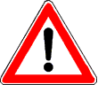
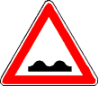
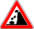
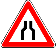
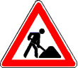
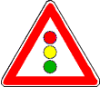
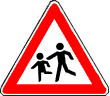
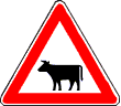
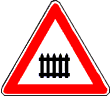
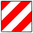
Warning signs appear before a particular hazard;
between 200 and 250m before the hazard outside of built-up areas
or just prior to the hazard in built-up areas.
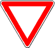
Give Way
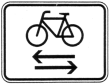
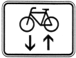
Advises of cycle traffic
|
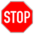
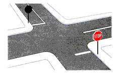
STOP
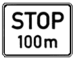
Possible supplementary
|

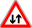
On-coming traffic has right-of-way

Advises of priority traffic flow
|

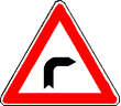
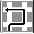
Right turn
|
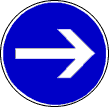
Turn right
|

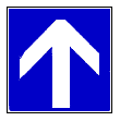
Straight-ahead or right
|
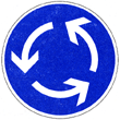
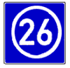
Roundabout
|

One-way
If the limit is 30kmh or less,
cycle traffic may be permitted in both directions
|

Keep right
|

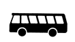
Bus/Tram stop
|

Taxi stand
|
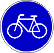
Cyclists
|
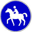
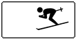
Riders
|

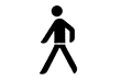
Pedestrians
|
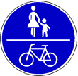
Shared footpath and cycleway
|
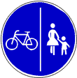
Divided footpath and cycleway
|

Start pedestrian zone
|

Start of cycle path
|

End of cycle path
|

End pedestrian zone
|

Designates low-emission vehicles
exempt from restriction
|

Bus lane
|
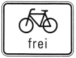
Restrictions may be relaxed by supplementary signs
such as the above for cycles, with the word frei.
|
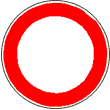
Vehicles of all types prohibited
|

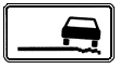
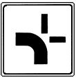
Supplementary sign
Road reserve is a recreation area
|

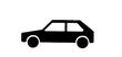
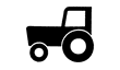
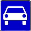
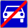
Cars and multi-track vehicles prohibited
|

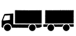
Trucks etc over 3.5t prohibited
|
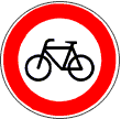
Cyclists prohibited
|

Motorcycles, etc prohibited
|
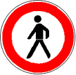
Pedestrians prohibited
|
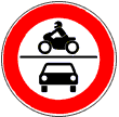
Combined prohibition
Motor cycles and cars
|
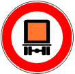
Placarded loads prohibited
|
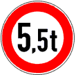
Vehicles over 5.5 t actual prohibited
|
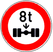
Permissible axle load
|
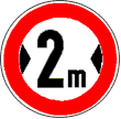
Width limit
|
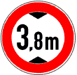
Height limit
|

Length limit
|
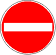
NO ENTRY
|

Snow chains must be carried
|
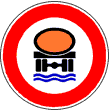
Vehicles with water-polluting
loads prohibited
|
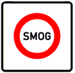
Traffic prohibition under smog conditions
|
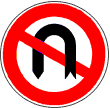
No U-turns
|
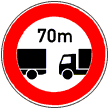
Minimum following distance
|
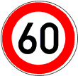
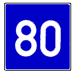
Speed limit
May be supplemented by

i.e. when wet
|
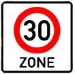
Speed restriction zone start
|

Speed restriction zone ends
|

Minimum speed (mandatory)
|
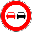
Overtaking prohibited for all vehicles
|
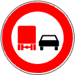
Overtaking prohibited for vehicles over 3.5t
|
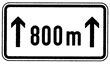
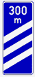
Possible supplementary sign indicating
distance for which restriction applies
|
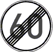
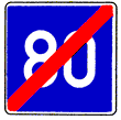
Ends corresponding maximum speed restriction
|
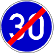
Ends corresponding minimum speed restriction
|

Ends overtaing restriction
|
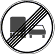
Ends overtaing restriction
|
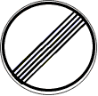
Ends ALL restrictions
|

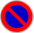
No stopping
|
Loading zone
|
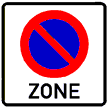
Restriction for a zone
|
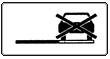
Prohibits stopping on verge.
|

Parking disc required
|
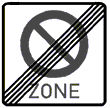
Ends loading zone restriction
|
Traffic conditions reports are broadcast on FM radio.
But usually only in German.